 |
This is a file from the Wikimedia Commons. Information from its description page there is shown below.
Commons is a freely licensed media file repository. You can help.
|
| Description |
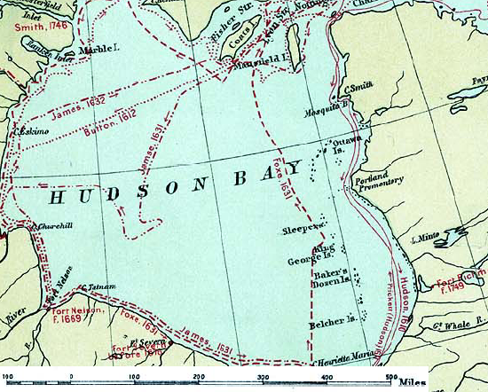
English: Map of the routes of the main European explorers in Hudson Bay, Canada.
|
| Date |
1906 |
| Source |
Excerpted from 1st Edition, 1906, Atlas of Canada - Routes of Explorers,1497 to 1905. |
| Author |
Department of the Interior, Ottawa |
Permission
( Reusing this file) |
Crown copyright expired.
| Public domainPublic domainfalsefalse |
 |
This Canadian work is in the public domain in Canada because its copyright has expired due to one of the following:
- 1. it was subject to Crown copyright and was first published more than 50 years ago, or
it was not subject to Crown copyright, and
- 2. it is a photograph that was created prior to January 1, 1949, or
- 3. the creator died more than 50 years ago.
|
|
|
|
česky | Deutsch | English | español | suomi | français | italiano | македонски | português | +/−
|
| Public domainPublic domainfalsefalse |
 |
This work is in the public domain in the United States because it was published (or registered with the U.S. Copyright Office) before January 1, 1923. Public domain works must be out of copyright in both the United States and in the source country of the work in order to be hosted on the Commons. If the work is not a U.S. work, the file must have an additional copyright tag indicating the copyright status in the source country.
|
|
File usage
The following pages on Schools Wikipedia link to this image (list may be incomplete):


