 |
This is a file from the Wikimedia Commons. Information from its description page there is shown below.
Commons is a freely licensed media file repository. You can help.
|
Summary
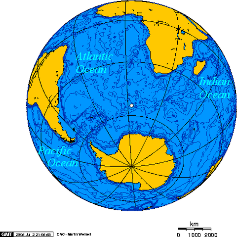
Orthographic projection centred over Bouvet Island
Licensing
| Public domainPublic domainfalsefalse |
 |
I, the copyright holder of this work, release this work into the public domain. This applies worldwide.
In some countries this may not be legally possible; if so:
I grant anyone the right to use this work for any purpose, without any conditions, unless such conditions are required by law.Public domainPublic domainfalsefalse
|
 |
The map has been created with the Generic Mapping Tools: http://gmt.soest.hawaii.edu/ using one or more of these public domain datasets for the relief:
- ETOPO2 ( topography/ bathymetry): http://www.ngdc.noaa.gov/mgg/global/global.html
- GLOBE ( topography): http://www.ngdc.noaa.gov/mgg/topo/gltiles.html
- SRTM ( topography): http://www2.jpl.nasa.gov/srtm/
|
 |
Permission is granted to copy, distribute and/or modify this document under the terms of the GNU Free Documentation License, Version 1.2 or any later version published by the Free Software Foundation; with no Invariant Sections, no Front-Cover Texts, and no Back-Cover Texts. A copy of the license is included in the section entitled GNU Free Documentation License. http://www.gnu.org/copyleft/fdl.htmlGFDLGNU Free Documentation Licensetruetrue
|
| Annotations |
This image is annotated: View the annotations at Commons |
|
|
File usage
The following pages on Schools Wikipedia link to this image (list may be incomplete):


