
File:Continental models.gif
Size of this preview: 640 × 325 pixels.
| |
This is a file from the Wikimedia Commons. Information from its description page there is shown below.
Commons is a freely licensed media file repository. You can help. |
Summary
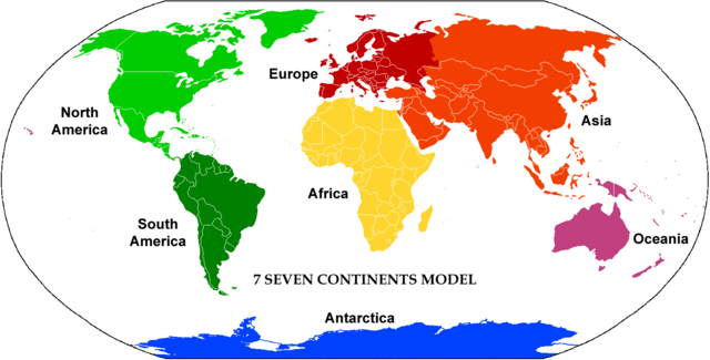
| Description |
English: Animated map showing the several existing continental models in the world. Oceanic islands are colored to match the most commonly associated continental mainland. Note that when such islands are included with Australia, the terms "Australasia" or "Oceania" are used for the resulting region.
|
| Date | |
| Source | Image by Alex Covarrubias (tweaked by Corticopious); adapted from Image:Continents vide couleurs.png |
| Author | Alex Covarrubias |
Licensing
 |
This work has been released into the public domain by its author, AlexCovarrubias at the English Wikipedia project. This applies worldwide. In case this is not legally possible: |
File usage
The following pages on Schools Wikipedia link to this image (list may be incomplete):
What is Schools Wikipedia?
Wikipedia for Schools is designed to make learning fun and easy. SOS Children's Villages helps more than 2 million people across 133 countries around the world. If you'd like to help, learn how to sponsor a child.