  | 
          
            This is a file from the  Wikimedia Commons. Information from its  description page there is shown below.  Commons is a freely licensed media file repository.  You can help. 
           | 


        Summary 


           | Description | 
           
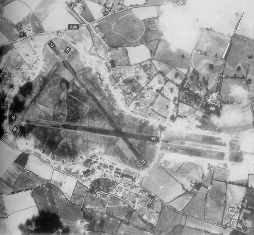
             English: Exeter Airfield, England 
            | 
          
          
           | Date | 
           20 May 1944 | 
          
          
           | Source | 
           Freeman, Roger A., Airfields Of The Ninth, Then And Now, 1993 (where the annotations are from) | 
          
          
           | Author | 
           Royal Ordinance Survey. | 
          
          
           Permission ( Reusing this file) | 


              | Public domainPublic domainfalsefalse | 


                | 
              This work is in the  public domain worldwide because it is an  Ordnance Survey map over 50 years old. Ordnance Survey maps are covered by  Crown Copyright which in this case expires 50 years after publication. Ordnance Survey does however ask that they be credited and that the date of publication be given.  Any ancillary rights gained through the creation of the electronic version are granted as freely usable under any circumstances. 
               | 


                | 
              This image, which was originally uploaded with an assertion of  Public Domain status, was reviewed on 19 June 2009 by the  administrator or  trusted user  NuclearWarfare ( talk), who confirmed the Public Domain status on that date. | 
              
             
            | 


       File usage
       
        The following pages on Schools Wikipedia link to this image (list may be incomplete):