
File:Satellite image of Europoort, Netherlands (4.25E 51.90N).png
Size of this preview: 640 × 439 pixels.
| |
This is a file from the Wikimedia Commons. Information from its description page there is shown below.
Commons is a freely licensed media file repository. You can help. |
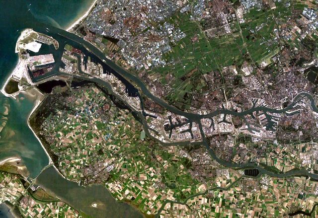
Satellite image of the Europoort, a port near Rotterdam, The Netherlands.
Screenshot from NASA's World Wind.
 |
This image is in the public domain because it is a screenshot from NASA’s globe software World Wind using a public domain layer, such as Blue Marble, MODIS, Landsat, SRTM, USGS or GLOBE.
|
|
File usage
The following pages on Schools Wikipedia link to this image (list may be incomplete):
The best way to learn
Learning is fun and easy with Schools Wikipedia. More than 2 million people benefit from the global charity work of SOS Childrens Villages, and our work in 133 countries around the world is vital to ensuring a better future for vulnerable children. Have you heard about child sponsorship? Learn more...