
File:Karte Bundesrepublik Deutschland.svg

Size of this preview: 354 × 479 pixels.
| |
This is a file from the Wikimedia Commons. Information from its description page there is shown below.
Commons is a freely licensed media file repository. You can help. |
Clickable version

| Description |
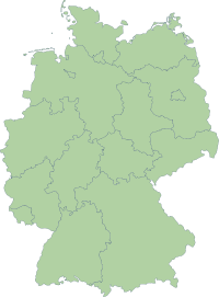
Deutsch: Karte der Bundesrepublik Deutschland mit eingezeichneten Grenzen der Bundesländer.
|
|||||
| Date | 14 October 2006 | |||||
| Source | Erstellt aus Material des gemeinsamen Datenangebotes aus dem gemeinsamen Portal der statistischen Ämter des Bundes und der Länder (DeStatis). | |||||
| Author | Portal der statistischen Ämter des Bundes und der Länder (DeStatis); David Liuzzo. | |||||
| Permission ( Reusing this file) |
|

File usage
The following pages on Schools Wikipedia link to this image (list may be incomplete):
Metadata
Did you know...?
Wikipedia for Schools was collected by SOS Children. Our 500 Children's Villages provide a home for thousands of vulnerable children. Beyond our Villages, we support communities, helping local people establish better schools and delivering effective medical care to vulnerable children. Go to http://www.soschildrensvillages.org.uk/sponsor-a-child to sponsor a child.