
File:Kashmir top.jpg
Size of this preview: 603 × 479 pixels.
| |
This is a file from the Wikimedia Commons. Information from its description page there is shown below.
Commons is a freely licensed media file repository. You can help. |
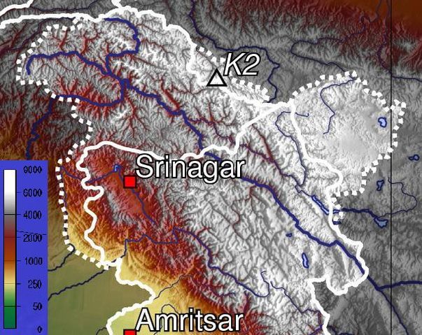
| Description | Topographic map of Jammu and Kashmir. Crop from http://en.wikipedia.org/wiki/Image:India_topo_big.jpg | ||||||||
| Date | 09:47, 25 November 2008 | ||||||||
| Source | http://en.wikipedia.org/wiki/File:Kashmir_top.jpg | ||||||||
| Author | BorgQueen ( | ||||||||
| Permission ( Reusing this file) |
|

File usage
The following pages on Schools Wikipedia link to this image (list may be incomplete):
Schools Wikipedia and SOS Children
Through Schools Wikipedia, SOS Children has brought learning to children around the world. Thanks to SOS Children, 62,000 children are enjoying a happy childhood, with a healthy, prosperous future ahead of them. There are many ways to help with SOS Children's Villages.