 |
This is a file from the Wikimedia Commons. Information from its description page there is shown below.
Commons is a freely licensed media file repository. You can help.
|
| Description |
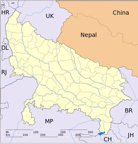
English: This map has been created by Faiz Haider, it is based on Map of Uttar Pradesh on National Portal of India. Equirectangular projection. Geographic limits of the map: top=31.00, bottom=23.50, left=76.60, right=85.00. |
| Date |
10 February 2009 (original upload date) |
| Source |
Transferred from en.wikipedia; transferred to Commons by User:Hanhil using CommonsHelper. |
| Author |
Original uploader was Faizhaider at en.wikipedia |
Permission
( Reusing this file) |
Released into the public domain (by the author).
|
Licensing
| Public domainPublic domainfalsefalse |
 |
This work has been released into the public domain by its author, Faizhaider at the wikipedia project. This applies worldwide.
In case this is not legally possible:
Faizhaider grants anyone the right to use this work for any purpose, without any conditions, unless such conditions are required by law.
|
File usage
The following pages on Schools Wikipedia link to this image (list may be incomplete):
This file contains additional information, probably added from the digital camera or scanner used to create or digitize it. If the file has been modified from its original state, some details may not fully reflect the modified file.


