
File:1755 Lisbon Earthquake Location.gif
1755_Lisbon_Earthquake_Location.gif (331 × 420 pixels, file size: 93 KB, MIME type: image/gif)
| |
This is a file from the Wikimedia Commons. Information from its description page there is shown below.
Commons is a freely licensed media file repository. You can help. |
Summary
| Description |
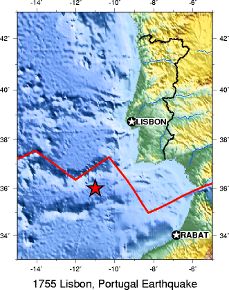
English: A map from the USGS showing the location of the 1755 Lisbon earthquake
|
| Date | |
| Source | Own work |
| Author | User:Stepanovas |
Licensing
 |
This image is in the public domain because it contains materials that originally came from the United States Geological Survey, an agency of the United States Department of the Interior. For more information, see the official USGS copyright policy. български | català | Deutsch | English | español | eesti | suomi | français | galego | italiano | 한국어 | македонски | മലയാളം | Nederlands | polski | português | русский | Türkçe | 中文 | 中文(简体) | +/− |
|
File usage
The following pages on Schools Wikipedia link to this image (list may be incomplete):
Schools Wikipedia facts
Schools Wikipedia has been carefully checked to give you the best learning experience. SOS Children's Villages helps more than 2 million people across 133 countries around the world. Learn more about child sponsorship.