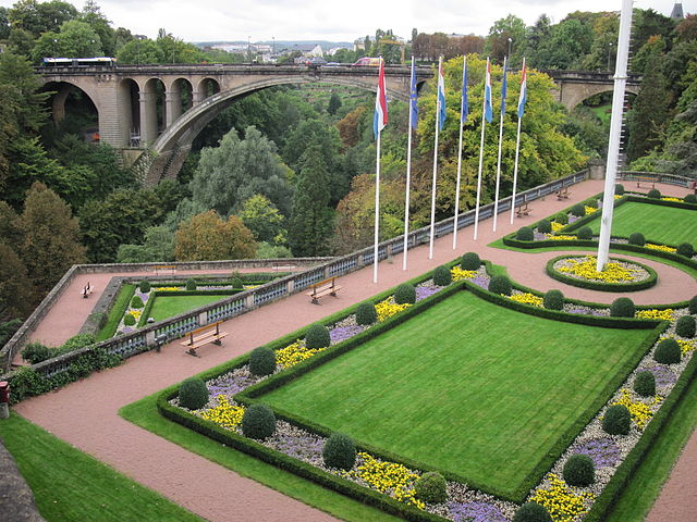
File:Topography of Luxembourg IMG 0943.JPG

Size of this preview: 640 × 480 pixels.
| |
This is a file from the Wikimedia Commons. Information from its description page there is shown below.
Commons is a freely licensed media file repository. You can help. |
Summary
| DescriptionTopography of Luxembourg IMG 0943.JPG |
English: Topography of Luxembourg
Русский: Топография Люксембурга
|
| Date | 24 September 2010 |
| Source | Own work |
| Author | Владимир Шеляпин |
|
Camera location |
49° 36′ 34.17″ N, 6° 7′ 42.85″ E |
View this and other nearby images on: Google Maps - Google Earth - OpenStreetMap | ( Info)49.609492269444;6.1285691327778 |
|---|
Licensing
|
|lang1=en|wiki1=wikipedia|article1=Luxembourg_(city) |lang2=ru|wiki2=wikipedia|article2=Люксембург_(город) |gallery1=Luxembourg City |ncats=1 }}
File usage
The following pages on Schools Wikipedia link to this image (list may be incomplete):
Metadata
This file contains additional information, probably added from the digital camera or scanner used to create or digitize it. If the file has been modified from its original state, some details may not fully reflect the modified file.
| Camera model | Canon PowerShot A2100 IS |
|---|---|
| Camera manufacturer | Canon |
| Exposure time | 1/125 sec (0.008) |
| F-number | f/3.2 |
| ISO speed rating | 160 |
| Date and time of data generation | 18:23, 24 September 2010 |
| Lens focal length | 6.4 mm |
| Altitude | 0 meters above sea level |
| Orientation | Normal |
| Horizontal resolution | 180 dpi |
| Vertical resolution | 180 dpi |
| Software used | Picasa 3.0 |
| File change date and time | 18:23, 24 September 2010 |
| Y and C positioning | Co-sited |
| Exif version | 2.21 |
| Date and time of digitizing | 18:23, 24 September 2010 |
| Image compression mode | 3 |
| Shutter speed | 6.96875 |
| APEX aperture | 3.34375 |
| Exposure bias | 0 |
| Maximum land aperture | 3.34375 APEX (f/3.19) |
| Metering mode | Pattern |
| Flash | Flash did not fire, auto mode |
| Colour space | sRGB |
| Focal plane X resolution | 16,460.905349794 |
| Focal plane Y resolution | 16,483.516483516 |
| Focal plane resolution unit | inches |
| Sensing method | One-chip colour area sensor |
| Custom image processing | Normal process |
| Exposure mode | Auto exposure |
| White balance | Auto white balance |
| Digital zoom ratio | 1 |
| Scene capture type | Standard |
| Unique image ID | 2e49d815bcea3c43f5f41fd5e6b7da13 |
| North or south latitude | North latitude |
| East or west longitude | East longitude |
Want to know more?
SOS Childrens Villages has brought Wikipedia to the classroom. SOS Children's Villages is famous for the love and shelter it brings to lone children, but we also support families in the areas around our Children's Villages, helping those who need us the most. Have you thought about sponsoring a child?
