 |
This is a file from the Wikimedia Commons. Information from its description page there is shown below.
Commons is a freely licensed media file repository. You can help.
|
Summary
| DescriptionTaiwan ROC political division map Taipei City (2010).svg |
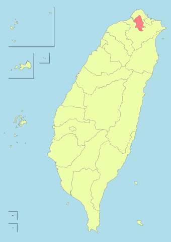
English: Taiwan_ROC_political_division_map_Taipei_City (2010)
Bân-lâm-gú: 2010-nî Tiong-huâ Bîn-kok Tâi-uân hîng-tsìng-khu-ue̍h ki̍p Tâi-pak-tshī(hún-âng-sik) ê uī-tì. 2010年中華民國台灣行政區劃及台北市(粉紅色)的位置。
|
| Date |
26 November 2010 |
| Source |
Own work |
| Author |
Luuva
|
|
This vector image was created with Inkscape. |
|
Licensing
|
I, the copyright holder of this work, hereby publish it under the following license:
|
File usage
The following pages on Schools Wikipedia link to this image (list may be incomplete):
This file contains additional information, probably added from the digital camera or scanner used to create or digitize it. If the file has been modified from its original state, some details may not fully reflect the modified file.
Schools Wikipedia was created by children's charity SOS Children's Villages. SOS Childrens Villages helps more than 2 million people across 133 countries around the world. Would you like to sponsor a child?


