 |
This is a file from the Wikimedia Commons. Information from its description page there is shown below.
Commons is a freely licensed media file repository. You can help.
|
| DescriptionBarbarie - 1806.jpg |
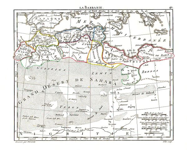
Español: La Barbarie en 1806.
English: 1806 map of North Africa — the Maghreb and Barbary Coast.
|
| Date |
1806 |
| Source |
http://www.atlassen.info/atlassen/frans/herisson/picslarge/heris1806k041.jpg |
| Author |
M. Witkam (Herisson, Atlas Portatif) |
Permission
( Reusing this file) |
| Public domainPublic domainfalsefalse |
 |
This work was first published in Tunisia and is now in the public domain because its copyright protection has expired by virtue of the Law No. 94-36 of February 24, 1994, on Literary and Artistic Property, enacted 1994, amended 2009. The work meets one of the following criteria:
- It is an anonymous work or pseudonymous work and 50 years have passed since the date of its publication (or creation, whatever date is the latest)
- It is a photographic work, and 50 years have passed since the date of its creation
- It is another kind of work, and 50 years have passed since the year of death of the author (or last surviving author)
- It is one of "official texts of legislative, administrative or legal nature and their official translations"
Before July 5, 2009, a photographic work was protected for 25 years. Pictures published before July 5, 1984 have already been placed into the public domain.
|
|
|
File usage
The following pages on Schools Wikipedia link to this image (list may be incomplete):
This selection has made Wikipedia available to all children. SOS Children helps more than 2 million people across 133 countries around the world. There are many ways to help with SOS Children's Villages.


