
File:Uk topo en.jpg
Size of this preview: 310 × 479 pixels.
| |
This is a file from the Wikimedia Commons. Information from its description page there is shown below.
Commons is a freely licensed media file repository. You can help. |
Description
| Description |
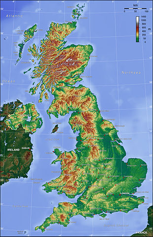
Deutsch: Topografische Karte des Vereinigten Königreichs (englische Beschriftung).
English: Topographic map of the United Kingdom.
|
| Date | 7 July 2006 |
| Source | Own work |
| Author | Captain Blood |
Licensing
| |
The map has been created with the Generic Mapping Tools: http://gmt.soest.hawaii.edu/ using one or more of these public domain datasets for the relief:
|
 |
Permission is granted to copy, distribute and/or modify this document under the terms of the GNU Free Documentation License, Version 1.2 or any later version published by the Free Software Foundation; with no Invariant Sections, no Front-Cover Texts, and no Back-Cover Texts. A copy of the license is included in the section entitled GNU Free Documentation License.
|
| This file is licensed under the Creative Commons Attribution-Share Alike 3.0 Unported license. | ||
|
||
| This licensing tag was added to this file as part of the GFDL licensing update.
|
File usage
The following pages on Schools Wikipedia link to this image (list may be incomplete):
Learn more about Schools Wikipedia
Schools Wikipedia was launched to make learning available to everyone. SOS Children's Villages is a global charity founded in 1949 to give children who have lost everything the childhood they deserve. Will you help another child today?