 |
This is a file from the Wikimedia Commons. Information from its description page there is shown below.
Commons is a freely licensed media file repository. You can help.
|
| Description |
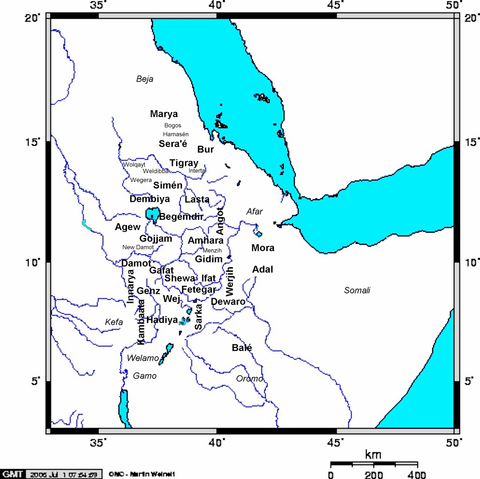
English: Created by me ( Yom). Map of Medieval Ethiopian provinces in large bold lettering, sub-provinces in small lettering, and neighboring tribes in italics (not part of Ethiopia in Medieval times - some may have had their own kingdoms).
|
| Date |
3 July 2006 (first version); 3 July 2006 (last version) |
| Source |
Transferred from en.wikipedia |
| Author |
Original uploader was Yom at en.wikipedia |
Permission
( Reusing this file) |
CC-BY-SA-3.0-MIGRATED; Released under the GNU Free Documentation License.
|
Licensing
Yom at the English language Wikipedia, the copyright holder of this work, hereby publishes it under the following license:
 |
Permission is granted to copy, distribute and/or modify this document under the terms of the GNU Free Documentation License, Version 1.2 or any later version published by the Free Software Foundation; with no Invariant Sections, no Front-Cover Texts, and no Back-Cover Texts.
Subject to disclaimers.www.gnu.org/copyleft/fdl.htmlGFDLGNU Free Documentation Licensetruetrue
|
|
File usage
The following pages on Schools Wikipedia link to this image (list may be incomplete):
You can learn about nearly 6,000 different topics on Schools Wikipedia. SOS Children's Villages is famous for the love and shelter it brings to lone children, but we also support families in the areas around our Children's Villages, helping those who need us the most. Learn more about child sponsorship.


