
File:Slavic peoples 6th century historical map.jpg
Size of this preview: 386 × 479 pixels.
| |
This is a file from the Wikimedia Commons. Information from its description page there is shown below.
Commons is a freely licensed media file repository. You can help. |
Summary
| Description |
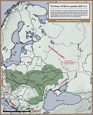
English: Approximate distribution of the early Slavs in the 6th century (shown in green). The red outline shows the approximate extent of the prehistoric (pre 6th century) Slavic homeland.
The green arrows show the ongoing expansions further into the Balkans and into the Baltic. The background map is a modern map of Europe (showing modern national borders and the Tsimlyansk Reservoir) |
| Date | 2010. |
| Source | Own work - Other example of similar map: http://izbornyk.org.ua/files/map_slov.htm |
| Author | SeikoEn |
Licensing
|

File usage
Wikipedia for Schools...
Wikipedia for Schools was collected by SOS Children. SOS Children believes that a decent childhood is essential to a happy, healthy. Our community work brings families new opportunities through education, healthcare and all manner of support. Sponsoring a child is a great way to help children who need your support.